A Colchester Street Puzzle Solved
- Andrew Mowbray
- Aug 4, 2023
- 2 min read
Updated: Jan 4, 2024
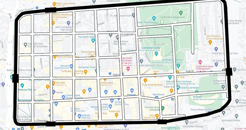
The street pattern of Colchester city centre within the city walls is a grid. Looking at old maps the grid has been there a long while. As Colchester started as a Roman colony, who laid out their towns and cities to regular grids, it could be assumed that the street pattern has persisted from Roman times. However, the real story is quite different.
When Roman Colchester was abandoned around 450AD, the buildings fell into ruin and the streets, being largely composed of compacted gravel, were buried, or washed away. The town was re-established in the 10th century when the Saxon King Edward the Elder threw out some Danes that had been occupying the ruins. He repaired the town walls and laid out a new street pattern using a grid system. It only aligned with the old Roman one in a few places as the Saxons had no knowledge of it.
The principal north/south street of North Hill and Head Street did align with its Roman predecessor due to the position of the gates in the wall at each end. The same was true with High Street which roughly lines up with its Roman predecessor due to the location of the East Gate. However High Street stops at its junction with North Hill and Head Street, whereas its predecessor continued to the Balkerne Gate in the west wall. This gate was closed by the Romans in the 4th century when the town ditch was extended across it so when the Saxons laid out the streets again there was no gate here so they did not extend the High Street to it.
At its eastern end by the War Memorial, High Street also has a semi circular bend in it where it went round the now long gone bailey wall of the Castle.
So, when walking around the city centre today, the streets you are in are not of Roman origin. However, they have been here over a thousand years which is still pretty amazing.


Thanks to Google Maps and HeritageDaily.com for the maps and overlay.


